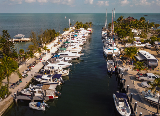
Blackfin Resort and Marina, Marathon, Florida, is an island paradise and a welcome slice…

The Storm in Malaspina Straight
10.
The Storm in Malaspina Straight
The waves we encountered in Malaspina Straight were steadily increasing in height and uncomfortableness.
Leaving the calm of Pender Harbour behind us, we headed out toward the Malaspina Straight, pointed southwest towards the Gulf Islands. We were aware of the storm that was to arrive later in the day and, based on the weather reports, we thought if we left early enough in the morning we’d miss the high winds, as it’s only about 36 miles across to Nanaimo, on Vancouver Island, our planned, end of the day, destination.
No such luck!
Not long after we left the calmness of the protected harbor, the waves we encountered were steadily increasing in height and uncomfortableness. You know things get rough when Lisa is not taking photos, but instead is holding on in anticipation of each roller coaster ride-type wave. In turn, Lisa really knows we’re in trouble when the captain looks worried, it hasn’t happened often, this was really only our second scary crossing in all our eight years of long-distance cruising. We’re fairly comfortable cruising with four or five-footers in our Ranger Tug, we’d rather not, but when caught off guard, we feel confident in our boat’s ability to ride things out. On this day the four or five-footers soon turned into six to eight and then upwards of twelve feet and things were getting ugly fast and we had yet to stick our nose out fully into the Strait of Georgia. Twelve miles into our crossing, we had to make a mutual decision to either continue our course, backtrack or ditch our plans for a full crossing and duck in somewhere. As luck would have it the crossing is divided by a group of smaller islands scattered northwest near the bigger Texada Island. With eight to twelve-footers hitting our port bow’s front quarter, we had a clear view of Jedediah Island, a B.C. Marine Park, a few miles off to our starboard, we quickly decided to head for shelter. Next, we had to decide exactly how to do that safely.
We could not just turn to starboard at any old time, the waves were too big, and being broached was a huge concern of ours. With Jim’s hand on the throttle he waited until he saw the calmest spot appear and, as a 12-footer rolled under the hull, he laid the throttle wide open and made a turn to starboard as we both held our breaths. With Kismet’s bow now fully turned toward Jedediah Island we had a strong following sea pushing us towards land, we were breathing easier the closer we got to the channel between Jedediah and Bull Islands.
It’s said that a boat can handle much more than we think it can and definitely more than we humans can, both being very true to form in this, the second of our two roughest cruising experiences ever.
Related Posts

This Post Has 0 Comments