GREAT LAKES AREA RANGER TUGS/CUTWATER BOATS 2025 RENDEZVOUS – Mackinaw City, Michigan – We just…

Back to Padre Bay Canyon – Last Night at Anchor in Lake Powell
19.
Back to Padre Bay Canyon – Last Night at Anchor in Lake Powell
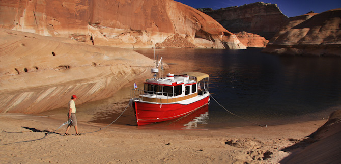
We spent our last night in Lake Powell anchored in Padre Bay, the same area we anchored our first night out. This time we found a little cove that was quite a bit more protected just over the hill from our first anchorage site. With a very clean, sandy beach off our bow the site was closely protected on three sides.


Jim is an old pro at burying the anchor now. It seems like it only takes a few minutes now to get settled versus the 45 min. we started out with.


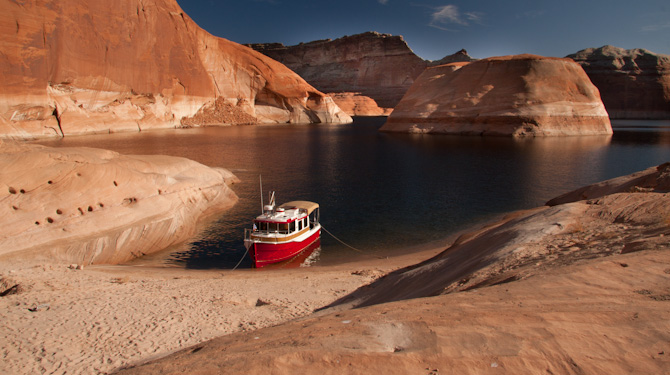
Here (above) you can see how our back was protected from wind and wakes off our aft deck.


Our bow headed into this hill, it had the most sand we’ve seen in one spot on the trip at an anchorage.


Morning light on Kismet (above).


Time to leave. We stalled as long as we could pulling up and stowing the anchors. Time to return to Wahweap Marina and civilization once again.


Hi Jim and Lisa – we are about to go to Lake Powell for a week in Sept. Am a little concerned about finding sandy beaches to anchor. do you happen to have GPS coordinates of some of the beaches in Padre Bay, Oak Bay, and others? Thanks for any help – Bill Johnston OVERDUE
Hi Bill:
I’d be glad to help out and please email again with any additional questions. In Padre Canyon I’ve got a couple for you. The one we really liked was a small cove at 37* 4.489 N 111*20.444 W and on this same piece of real-estate there is a sandy beach that covers 2/3 of the little island. We always had Lisa on the bow as we approached shore looking for the best sandy landing spots. In Dungeon try 37* 4.768 N 111* 9.444 W In Oak Bay there are a lot of choices. We used a spot at 37* 6.917 N 110* 57.415 W on two separate stops. In Cottonwood we stayed two nights at 37* 14.314 N 110* 52.017 W
Do you have the Lake Powell Map put out by Fish n Map Co.? they sell them at the marinas as well as a nice color photo/caption highlight fold up guide. What are you using for a GPS? We used our iPad with a Navionics US app as our GPS and it worked just fine.
Also keep in mind these beach anchorages change every year with the changing water level in the lake. We were there in September 2011 and the water was about 50 feet…..yes 50 feet higher then the prior fall….and this makes a difference in the beaching with sandy landings.
Have a grand time.
Jim